Gulludere (Rose) & Kizilcukur (Red) Valleys
Rose Valley and Red Valley Cappadocia Hiking Guide
Rose Valley and Red Valley are connected hiking landscapes east of Göreme, known locally as Güllüdere and Kızılçukur. The area combines pink and red volcanic cliffs, rock-cut churches, pigeon houses, vineyards, narrow passages and one of the best-known sunset viewpoints in Cappadocia.
A short walk may take about two hours. A longer route connecting Rose Valley, Red Valley and Meskendir Valley can require four to five hours.
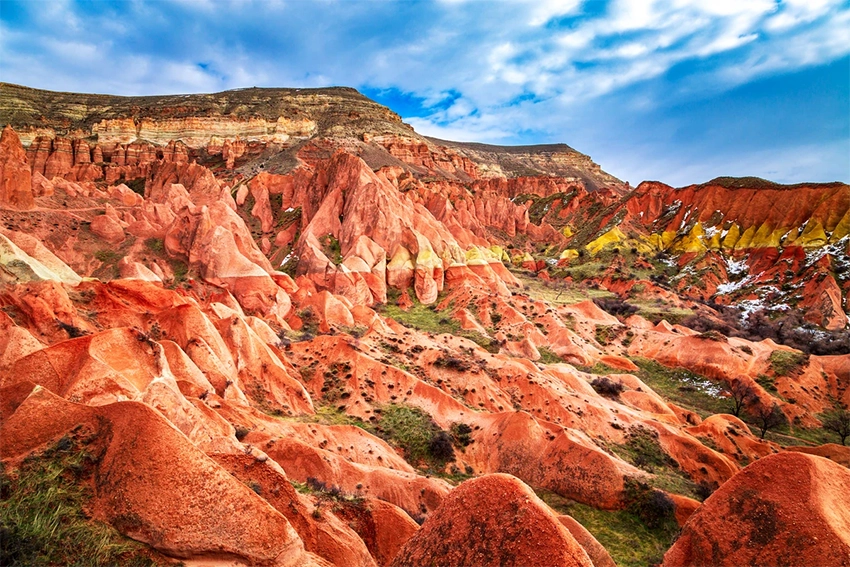
The valleys are not one fixed trail with a single entrance and exit. Several paths connect Göreme, Çavuşin, Meskendir Valley and the Kızılçukur ridge.
The best route depends on available time, weather, fitness level and the planned return transport.
These valleys should not be approached as one clearly marked circular trail. Several official, local and agricultural paths intersect, and two maps may use different names for the same junction.
The safest planning method is to choose the starting point, intended exit and return transport before entering. Decide whether the walk will be out-and-back, circular or one-way rather than selecting directions at every junction.
Short routes can be completed independently in stable weather, but long combinations require stronger navigation, realistic daylight planning and enough water. Distance alone does not show the difficulty of carved steps, loose slopes and route-finding.
Why Visit Rose Valley and Red Valley?
- Sunset colors: Late-afternoon light strengthens the pink, red and orange tones of the cliffs.
- Flexible routes: Güllüdere I, Güllüdere II, Kızılçukur and Meskendir can be combined in different ways.
- Rock-cut churches: The valleys contain chapels, monastic spaces and surviving Byzantine paintings.
- Agricultural history: Vineyards, pigeon houses and grape-processing spaces remain visible.
- Easy access from Göreme: Several routes begin close to the town.
- Different experiences: Visitors can choose a short walk, a full hike or a road-accessible sunset viewpoint.
Where Are Rose Valley and Red Valley?
How to Plan a First Hike
For a first visit, choose one Rose Valley branch and one confirmed exit. Trying to walk every Güllüdere and Kızılçukur connection in one afternoon often creates confusion rather than a better experience.
An out-and-back route is simplest when transport is uncertain. A one-way route provides more variety but requires a driver, taxi, minibus or second vehicle at the finishing point.
Start with an offline map already downloaded and mark the exact trailhead. Searching only for Rose Valley can lead to an upper viewpoint, a lower hiking entrance or a road on the opposite side of the valley network.
Check the weather before departure. Heavy rain can create mud, runoff and slippery carved steps, while summer heat can make exposed sections difficult even when the route is short.
Leave one hour of daylight as a safety margin. Sunset should be viewed from a road-accessible finish rather than from an unfamiliar valley branch that still requires navigation.
Where Are Rose Valley and Red Valley?
The valleys lie east and northeast of Göreme, between Göreme, Çavuşin and the Kızılçukur ridge.
Common access points include:
- Trail entrances east of Göreme
- The Meskendir Valley approach
- Paths from Çavuşin
- The road-accessible Kızılçukur viewpoint
- Connections from the upper Aktepe plateau
Digital maps do not always use the same names for each branch. Download an offline map before entering the valleys and follow current signs where available.
Trailhead names can also differ between drivers and online maps. Share a pin, screenshot or written coordinates with the driver instead of relying only on Güllüdere, Rose Valley or Red Valley.
The road-accessible Kızılçukur viewpoint is not the same as a lower valley entrance. Visitors dropped at the viewpoint may begin with a descent, while walkers starting near Göreme usually approach from below.
Some access roads cross working vineyards and private agricultural land. Park only in recognized areas and do not block gates, tractors or field entrances.
Are Rose Valley and Red Valley the Same?
No, but they are connected parts of the same large valley network.
Rose Valley, or Güllüdere, generally refers to the branching system known as Güllüdere I and Güllüdere II. It contains pink and cream cliffs, churches, vineyards, orchards and pigeon houses.
Red Valley, or Kızılçukur, refers mainly to the red-colored canyon and ridge near the famous sunset viewpoint.
The exact boundary can change between maps and local descriptions. For hiking purposes, it is easier to treat them as connected sections.
Güllüdere I and Güllüdere II are branch names rather than difficulty grades. One branch is not automatically easier simply because it appears first on a map.
Kızılçukur may refer to the canyon, the upper ridge or the sunset viewpoint. Confirm which location is intended whenever arranging transport or meeting another group.
How Were the Valleys Formed?
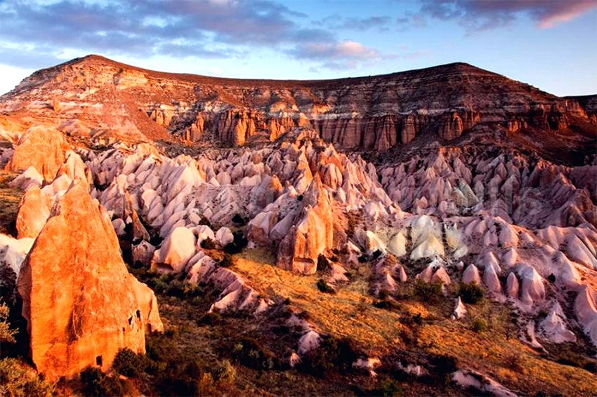
The valleys developed from volcanic deposits created during repeated eruptions in the wider Cappadocia region.
Ash, pumice and other volcanic material hardened into layers of tuff and ignimbrite. Rainwater, surface runoff, frost, gravity and wind gradually cut channels through those layers.
Softer sections disappeared faster, while stronger sections remained as ridges, pinnacles and narrow walls.
The pink, red, cream and orange colors come from differences in minerals, oxidation and weathering. Sunlight changes how strongly these colors appear.
The volcanic layers do not weather uniformly. Differences in hardness, porosity, mineral content and fracture patterns create narrow ridges, rounded walls and deeply cut channels within a short distance.
Water follows cracks and low points, gradually enlarging channels. Repeated wetting, drying and winter freezing weaken exposed surfaces, especially around steep steps and rock-cut entrances.
This continuing erosion means that a trail can change after storms or winter weather. A path visible in an older photograph may be narrower, blocked or redirected when visited.
Loose material at the base of a slope may indicate active weathering. Do not rest directly below fractured walls or cross fresh rockfall debris to preserve an old route.
Read the guide to the formation of Cappadocia's fairy chimneys for a fuller geological explanation.
Why Does Red Valley Look Red at Sunset?
The effect is both geological and visual.
The rock already contains warm mineral colors. Near sunset, the lower angle of the sun creates warmer light and longer shadows across the cliffs.
The rocks do not suddenly change color. Their natural red and orange tones simply become stronger.
Clouds, dust and atmospheric haze affect the final view, so the same ridge can look different every evening.
The strongest color may appear before the sun reaches the horizon, especially when clouds block the final minutes of direct light. Arrive early rather than timing the visit only for the listed sunset minute.
After the sun disappears, the cliffs can lose color quickly while the paths become harder to read. Begin the return before complete darkness unless the vehicle is waiting directly at the viewpoint.
Rose Valley and Red Valley Hiking Routes
Distances below are approximate because access points and side paths vary. GPS tracks may begin at a parking area, a hotel in Göreme or an upper ridge, creating different totals for routes with the same name.
Do not judge a route only by kilometers. A short section with steep steps, tunnels and unclear junctions may take longer than a wider agricultural path of greater distance.
Short Rose Valley Walk
A short walk can begin from a Göreme-side entrance, follow one lower section of Rose Valley and return along the same path.
- Distance: Approximately 2 to 4 kilometers
- Time: Approximately 1.5 to 2.5 hours
- Best for: Limited time and visitors seeking an easier introduction
Güllüdere I and Güllüdere II
An out-and-back short walk reduces transport risk and allows visitors to turn around before heat, fatigue or weather becomes a problem.
Choose a clear turnaround point before starting. Side paths can make a short walk unexpectedly long when every church or viewpoint is added.
Related Tours
Popular experiences for this destination
 Adventure
Trekking Tours Cappadocia
Hike Cappadocia’s spectacular valleys, fairy chimneys, and cave dwelli…
Vip Mix Tour Cappadocia
Experience the ultimate Cappadocia highlights in comfort-historic vall…
 Adventure
ATV Tour Cappadocia
Ride powerful ATVs through Cappadocia’s unique valleys, fairy chimneys…
 Red Tour
Red Tour Cappadocia
Discover Göreme Open-Air Museum, Avanos pottery workshops, and breatht…
 Adventure
Horseback Riding Tour Cappadocia
Experience Cappadocia on horseback, riding through valleys, hidden tra…

Classic Car Tour Cappadocia
Step into nostalgia with a vintage classic car ride through Cappadocia…
 Adventure
Jeep Safari Tour Cappadocia
Take an off-road jeep adventure across Cappadocia’s rugged landscapes,…
 Blue Tour
Blue Tour Cappadocia
Explore hidden valleys, ancient churches, and cultural gems on Cappado…
Nostalgic Electric Car Tour Cappadocia
Ride eco-friendly nostalgic electric cars through Cappadocia’s valleys…
Professional Photo Shoot Cappadocia
Capture your Cappadocia moments with a guided professional photo shoot…
Cappadocia Rent A Car
Explore Cappadocia freely at your own pace with flexible car rental op…
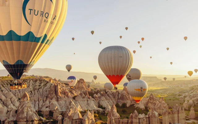 Balloon
Cappadocia Hot Air Balloon Tour
See Cappadocia from the air at sunrise on a professionally operated ho…
Güllüdere I and Güllüdere II
The two main Rose Valley branches can be connected through paths passing churches, vineyards, pigeon houses and narrow formations.
- Distance: Approximately 4 to 7 kilometers
- Time: Approximately 2.5 to 4 hours
- Difficulty: Moderate
Some connections include steep steps, narrow passages and loose slopes. Route conditions may change after rain, snow or maintenance work.
The branches contain multiple church and café detours. Each detour should be treated as additional time rather than assumed to lie directly on the main line.
When a connector feels significantly harder than expected, return to the previous junction. Unofficial shortcuts can end at private land, eroded ledges or near-vertical steps.
Red Valley Sunset Route
A popular option is to walk through part of Rose or Red Valley and finish near the upper Kızılçukur viewpoint.
- Time: Begin approximately 2 to 3 hours before sunset
- Best for: Sunset photography
- Main concern: Reaching the road before darkness
Arrange return transport before starting. Do not plan to walk back through unfamiliar valley branches after sunset.
Agree on a fixed pickup time and exact meeting point. The main platform, entrance gate and roadside parking area can be separated by several minutes of walking.
Send the driver a live location while reception is available. Do not wait until darkness to explain which Red Valley exit you reached.
Carry a small light even when the plan is to finish before sunset. Delays at churches, junctions or crowded ridge paths can extend the route.
See the Red Valley sunset guide for viewpoint and photography planning.
Meskendir, Red Valley and Rose Valley
This longer one-way route connects Meskendir Valley, Red Valley and Rose Valley before finishing toward Çavuşin or another arranged exit.
- Distance: Approximately 7 to 10 kilometers
- Time: Approximately 4 to 5 hours
- Difficulty: Moderate
- Best for: Experienced walkers with offline navigation
Small route changes can add considerable distance. Do not begin this combination late in the afternoon.
This route is better treated as a point-to-point hike with a confirmed exit. Reversing the entire route after a navigation mistake may add several hours.
Meskendir includes enclosed passages and shaded sections, while upper Red Valley routes can be more exposed. Temperature and surface conditions may change noticeably within the same hike.
Carry enough water for the complete route. Seasonal cafés cannot be used as guaranteed supply points.
Finish in Çavuşin
Çavuşin is one of the most practical finishing points for a one-way hike.
The village provides access to restaurants, cafés, taxis and some daytime local transport connections. After several hours in the valleys, reaching the village center feels like a natural reward.
Confirm the last minibus departure before beginning the hike. Evening services may finish earlier than expected.
Save a taxi number as a backup. Reaching Çavuşin does not guarantee immediate transport during quiet periods or late evenings.
The old rock settlement and church areas around Çavuşin require additional climbing. Add them only when daylight and energy remain rather than treating them as an automatic extension.
How Difficult Is the Hike?
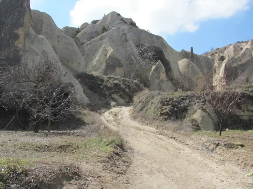
The main routes are usually described as moderate, but some branches are considerably harder than others.
Moderate does not mean uniform. The same route can feel easy on dry ground and difficult after rain, snow or repeated ATV traffic loosens the surface.
Hikers with knee concerns often find descents on carved steps more demanding than climbs. Trekking poles may help on wider paths but can be awkward inside narrow passages.
Possible conditions include:
- Loose volcanic soil
- Steep carved steps
- Short tunnels
- Narrow passages
- Uneven agricultural tracks
- Slippery rock after rain
- Ice during winter
- Exposed ridges
- Unclear path junctions
Some changing or unofficial connections may include steep fixed ladders or near-vertical steps. These are not suitable for people with serious vertigo, large dogs, heavy camera bags or limited balance.
Do not force yourself through a difficult connector. Return to the previous junction and use a gentler recognized path.
No technical climbing should be required on a normal public hiking route. A path requiring dangerous climbing is probably not the correct route.
Do not copy another hiker through a difficult opening without checking whether it belongs to your intended trail. People may be following a different route, returning from a dead end or using an unofficial shortcut.
Working farms and grazing areas remain part of the landscape. Livestock guardian dogs may protect animals or fields. Do not run, shout, feed them or approach livestock. Keep a calm distance and move with the group.
During thunderstorms, leave exposed ridges and narrow drainage channels. Heavy rain can create rapid runoff even when the storm begins outside the visible valley.
The natural trails are not wheelchair accessible. Visitors with limited mobility can use road-accessible viewpoints around the upper Kızılçukur area, subject to current conditions.
Rock-Cut Churches of Rose and Red Valleys

The valleys contain churches and chapels created during different periods of Byzantine Cappadocia.
Some preserve simple crosses and geometric decoration, while others contain painted figures of Christ, the Virgin Mary and saints.
A church may contain an early carved structure, a later painted layer and rooms reused for storage or pigeon breeding.
Church names and spellings vary between maps. A Turkish descriptive name, an English translation and a traditional dedication may all refer to the same monument.
Not every church is permanently open. Rock stability, conservation work, private use or local management can change access without removing the monument from older maps.
Examine painted surfaces from the permitted floor area. Do not touch frescoes, use flash when prohibited or apply water to reveal faded pigment.
Rock-cut churches should also be read within their agricultural setting. Vineyards, storage rooms and pigeon houses explain how religious communities were supported in daily life.
Read the guide to Christianity in Cappadocia for the wider historical background.
Yovakim and Anna Church
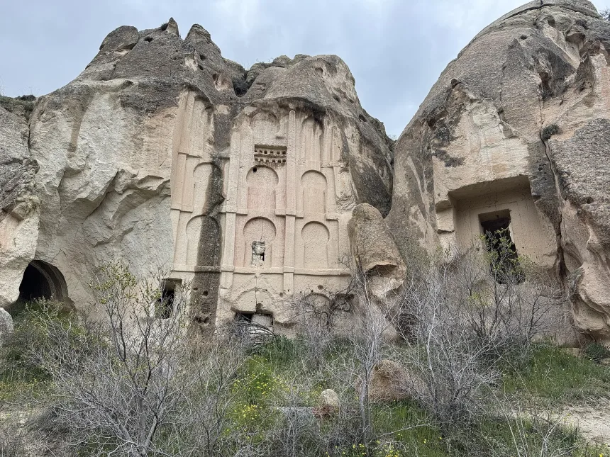
Yovakim and Anna Church is named after Joachim and Anna, who appear in Christian tradition as the parents of the Virgin Mary.
The surviving decoration is associated with Mary and her family. The name may appear on maps as Joachim and Anna, Ioachim and Anna or Yovakim-Anna.
The building should not be identified from the translated name alone because several map platforms place labels differently. Compare the entrance, nearby paths and current signs before assuming you have reached the church.
Allow time to view the architecture as well as the surviving paintings. Focusing only on one named scene can hide later alterations and connected spaces.
Ayvalı Church
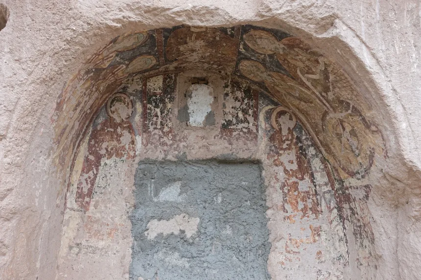
Ayvalı is a group of connected rock-cut spaces rather than one isolated chapel.
The complex contains a church and rooms used for religious, residential, storage or working purposes.
Do not enter blocked or unsupported chambers.
The connected rooms demonstrate that a church could belong to a larger working complex. Their original and later uses may differ, so avoid assigning every side chamber to monastic residence without evidence.
Openings, floors and ceilings may be fragile. Remain on the clearly used visitor area even when another chamber appears easy to enter.
Üç Haçlı Church
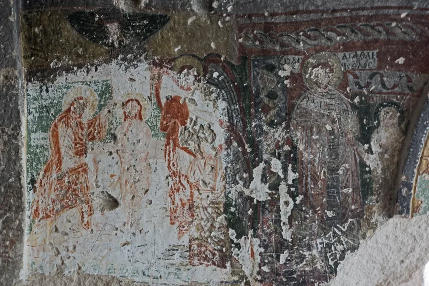
Üç Haçlı means Three Crosses. The name refers to prominent crosses connected with the ceiling decoration.
The monument contains more than one decorative phase. The carved crosses and painted scenes should not automatically be assigned to the same date.
Maps may label it Üç Haçlı Kilise, Three Cross Church or Saint Agentangeus Church.
The difference between carved and painted decoration matters. They may belong to separate phases and should not be described as one single program created at the same time.
A seasonal café may operate nearby, but church access and café opening are separate matters. Do not assume that a closed café means the monument is inaccessible or that an open café confirms safe entry.
Columned Church
A church appearing on some maps as Kolonlu, Sütunlu or Direkli is known for carved supports dividing its interior.
Similar names are used for churches elsewhere in Cappadocia, so it should not be confused with Direkli churches in Zelve or Ihlara.
Use the valley location and surrounding route to distinguish it. Searching only for Columned Church can direct visitors to a monument in another part of Cappadocia.
The Seasonal Cave Café
Small seasonal tea gardens or cave cafés sometimes operate near popular church routes and valley junctions, including the area around Üç Haçlı Church.
They may serve Turkish tea, fruit juice, water and simple snacks. These stops can feel like a small oasis during a long summer walk.
Carry some Turkish lira because card connections may be unreliable. Do not depend on the café for drinking water because opening days and seasons can change.
Prices, seating and operating hours are determined by the individual business. Carry out all trash and do not leave bottles or food packaging beside church entrances.
A café stop can extend the route by 20 to 40 minutes. Include that time when planning a sunset finish.
Pigeon Houses, Vineyards and Daily Life
The valleys were not empty wilderness. Residents cultivated vines and fruit trees, raised pigeons and used carved rooms for storage and grape processing.
Related Tours
Popular experiences for this destination
AdventureTrekking Tours Cappadocia
Hike Cappadocia’s spectacular valleys, fairy chimneys, and cave dwelli…
Vip Mix Tour Cappadocia
Experience the ultimate Cappadocia highlights in comfort-historic vall…
AdventureATV Tour Cappadocia
Ride powerful ATVs through Cappadocia’s unique valleys, fairy chimneys…
Red TourRed Tour Cappadocia
Discover Göreme Open-Air Museum, Avanos pottery workshops, and breatht…
AdventureHorseback Riding Tour Cappadocia
Experience Cappadocia on horseback, riding through valleys, hidden tra…
Classic Car Tour Cappadocia
Step into nostalgia with a vintage classic car ride through Cappadocia…
AdventureJeep Safari Tour Cappadocia
Take an off-road jeep adventure across Cappadocia’s rugged landscapes,…
Blue TourBlue Tour Cappadocia
Explore hidden valleys, ancient churches, and cultural gems on Cappado…
Nostalgic Electric Car Tour Cappadocia
Ride eco-friendly nostalgic electric cars through Cappadocia’s valleys…
Professional Photo Shoot Cappadocia
Capture your Cappadocia moments with a guided professional photo shoot…
Cappadocia Rent A Car
Explore Cappadocia freely at your own pace with flexible car rental op…
BalloonCappadocia Hot Air Balloon Tour
See Cappadocia from the air at sunrise on a professionally operated ho…
Pigeon manure was collected as fertilizer for vineyards and agricultural fields. Some dovecote entrances were painted white or decorated to attract birds.
Rock-cut basins were used for crushing grapes. The juice could be processed into wine, molasses, dried products or other foods.
These agricultural features remain part of a working landscape. Do not pick grapes, fruit or vegetables without permission, even when a field appears unattended.
Painted pigeon-house entrances may be visible high on the cliffs. Use a camera zoom rather than climbing toward them.
Crushing basins and channels should be viewed without stepping inside. Repeated foot traffic wears carved surfaces and introduces dirt into the original drainage features.
Learn more in the guide to Cappadocia wine tasting and underground cellars.
Red Valley Sunset Viewpoint
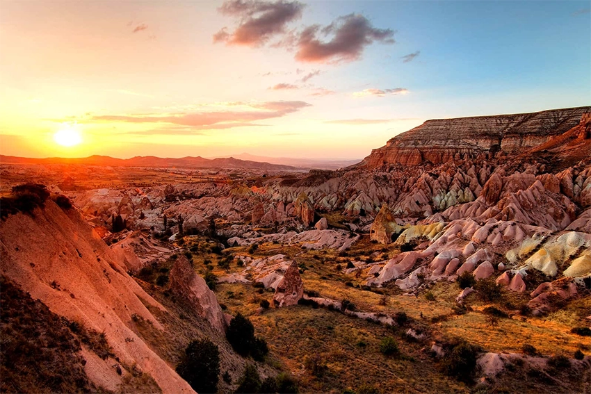
The upper Kızılçukur viewpoint is one of Cappadocia's best-known sunset locations. It can be reached directly by road or used as the finishing point of a hike.
Parking arrangements, access conditions and local charges may change.
The main platform can become crowded with cars, tour vehicles, music and photography groups. Arriving 45 to 60 minutes before sunset usually provides more time to choose a safe viewing position.
The viewpoint is road accessible, but the ground can still be uneven and dusty. Keep away from unsupported edges and do not step backward while framing photographs.
A sunset stop does not require a full valley hike. Visitors with limited mobility or little time can drive to the upper area, subject to current access conditions.
How to Return After Sunset
Do not rely on finding a taxi after the sun has disappeared. Many visitors request vehicles at the same time, and mobile reception may be weak.
Arrange one of the following before beginning the hike:
- A fixed pickup time with a driver
- A transfer organized by the hotel
- A tour vehicle waiting at the viewpoint
- A saved local taxi number and confirmed meeting point
- A vehicle parked at the final road-accessible exit
Share the exact meeting point with the driver before entering the valley. The phrase Red Valley can refer to several different locations.
Confirm whether the driver will wait at the entrance gate, main platform or roadside exit. Large vehicles may use a different collection point from private cars.
Keep the hotel name and phone number saved offline. Weak reception and several simultaneous pickups can make last-minute communication difficult.
Finding a Quieter View
The main platform can become crowded with tour vehicles, music and photography groups.
Quieter views may be found by continuing a short distance along recognized ridge paths away from the central parking area. Remain on clear paths and keep away from unsupported cliff edges.
Do not follow an unknown ridge after darkness simply to avoid the crowd.
Quieter does not mean safer. Ridge surfaces may contain cracks, loose edges and narrow sections that are difficult to judge in low light.
Use an established viewpoint rather than creating a new path through vegetation or cultivated land.
Sunrise or Sunset?
Balloons: Sunrise. Balloon views depend on wind direction and cannot be guaranteed.
Colors: Sunset. The red and orange cliffs appear strongest under low late-afternoon light.
Best balance for independent hikers: Begin several hours before sunset and leave the valley before darkness.
Read the Cappadocia hot-air balloon guide for information about changing flight paths.
Sunrise access requires extra caution because trail surfaces are difficult to inspect in darkness. Use a road-accessible viewpoint or join a planned route instead of entering unfamiliar lower valleys before dawn.
Balloon visibility is a weather and wind outcome, not a guaranteed feature of Rose Valley accommodation or hiking routes.
Best Season for Hiking
Spring
April and May usually bring comfortable temperatures and greener sections around vineyards and orchards. Rain can make the trails muddy.
Summer
Summer can be very hot, and shade is limited. Begin early or later in the afternoon.
Autumn
September and October offer comfortable hiking weather, vineyard colors and strong photography conditions.
Winter
Snow can create dramatic views, but ice may make carved steps and steep slopes unsafe.
Winter daylight is short, and shaded passages can remain icy after open ridges have thawed. Avoid long one-way routes unless the complete exit plan is clear.
Strong wind can increase exposure on upper ridges in every season. Carry a light layer outside midsummer and avoid loose hats or unsecured equipment.
Valley Survival Checklist
- Download an offline map and mark the planned exit.
- Carry enough water for the full route and do not rely on seasonal cafés.
- Wear shoes with reliable grip.
- Keep a charged phone, a small light and some cash.
- Arrange return transport before a one-way sunset hike.
- Begin long routes with several hours of daylight remaining.
Facilities are limited inside the valley network. Use toilets and purchase supplies before entering.
Also save the driver, hotel and emergency contact information offline. A phone battery should not be used continuously for video if it is also needed for navigation and transport.
Carry a small first-aid kit for minor cuts and blisters. Loose volcanic surfaces can cause falls even on nontechnical routes.
Facilities are limited inside the valley network. Use toilets and purchase supplies before entering.
Guided or Independent Hiking?
Independent Hiking
Independent hiking is suitable for visitors with offline navigation, suitable footwear and enough daylight.
Choose the intended exit before starting and avoid following every side path.
Independent hikers should be comfortable turning back. Completing the planned route is less important than leaving the valley with enough daylight.
Guided Hiking
A guided Cappadocia trekking tour is useful for church identification, historical interpretation and one-way transport planning.
A local guide also reduces the chance of confusing similarly named churches or taking the wrong agricultural path.
Ask whether transport from the finishing point is included. A guided walk without return logistics may still leave the group at a distant exit.
Guide quality matters most for church interpretation, route selection and timing. A route should be adjusted to weather and group ability rather than followed exactly in every condition.
Other Ways to Experience the Valleys
Sunset ATV Tour
A Cappadocia ATV tour may follow authorized tracks around Rose and Red Valleys.
This is a practical option for visitors who want sunset colors without completing a long hike.
ATVs use wider authorized tracks and do not enter every narrow hiking branch. Dust and vehicle noise may affect nearby walking sections around common sunset hours.
Hikers should step safely to the side on shared tracks and wait for dust to clear before continuing.
Horseback Riding
A Cappadocia horseback riding tour may use wider paths around the valley network.
The exact route depends on weather, riding experience and current access restrictions.
Horse routes should remain on permitted tracks. Walkers should avoid sudden movements around horses and follow the guide's directions when passing.
Photography Tour
A professional Cappadocia photo shoot can use the colored cliffs and sunset ridges as backgrounds.
Photography sessions should not block narrow trails or place clients on unstable edges. Confirm walking distance, footwear and return transport before arriving in formal clothing.
How to Get to Rose Valley and Red Valley
From Göreme
Some entrances can be reached on foot from Göreme. Remember that the approach adds extra distance before the actual valley route begins.
A taxi or transfer to an upper trailhead can make a one-way hike easier.
Tell the driver whether the start is a lower Göreme-side trailhead or the upper Kızılçukur viewpoint. These are not interchangeable drop-off points.
From Çavuşin
Çavuşin provides access to the northern Rose Valley branches. Confirm the exact entrance because agricultural tracks can look very similar.
Starting from Çavuşin can simplify a one-way finish toward Göreme or an upper ridge, but the direction should be chosen before entering the branch network.
From Ürgüp or Uçhisar
Travelers staying outside Göreme normally need a taxi, rental car, transfer or guided tour.
By Rental Car
A rental car is useful for reaching the upper sunset viewpoint. A circular walk or second vehicle is needed when the hiking exit differs from the starting point.
Do not leave valuables visible in a parked vehicle. Confirm whether the parking area remains accessible after sunset and whether a gate or local closing arrangement applies.
See the guide to getting to and around Cappadocia for local transport planning.
Suggested Half-Day Route
- Start: Enter from a confirmed Göreme-side or upper Rose Valley trailhead.
- First section: Follow one Güllüdere branch and visit an accessible church.
- Middle section: Continue toward Red Valley through vineyards and pigeon houses.
- Late afternoon: Climb toward the Kızılçukur ridge.
- Finish: Reach the road-accessible viewpoint before sunset.
- Return: Use a pre-arranged taxi, driver or transfer.
Suggested Full Route
This half-day route should be adjusted when church visits, café stops or photography are priorities. Each additional stop reduces the time available for the final climb.
When transport is not confirmed, turn back through the same Rose Valley branch instead of continuing toward an uncertain sunset exit.
Suggested Full Route
- Morning: Begin from Göreme or Meskendir Valley.
- Late morning: Continue through Red Valley.
- Midday: Rest in a safe shaded area.
- Afternoon: Explore one or both Güllüdere branches.
- Finish: Exit toward Çavuşin for food, transport and an easier return.
Do not start the full route late in the day.
The full route is best started in the morning. Select one Güllüdere branch rather than attempting every side trail after already crossing Meskendir and Red Valley.
When finishing in Çavuşin, confirm food and transport before the final descent. Seasonal businesses and minibuses may stop earlier outside summer.
Places to Visit Nearby
Göreme
Göreme offers cave hotels, restaurants, sunrise viewpoints and access to several central valleys.
Göreme Open-Air Museum
The Göreme Open-Air Museum contains some of Cappadocia's most important Byzantine churches and frescoes.
Çavuşin
Çavuşin contains an old rock settlement, historic churches and trail connections toward Rose Valley.
Love Valley
Love Valley is known for tall pillar-shaped formations and a very different geological landscape.
Zemi Valley
Zemi Valley offers a greener walking corridor with tunnels, churches and access toward Göreme.
Nearby sites should not be added automatically after a long hike. Göreme Open-Air Museum and Çavuşin's upper settlement both require additional walking and are better scheduled separately when energy or daylight is limited.
Responsible Hiking
- Remain on recognized paths.
- Do not enter closed or unstable caves.
- Do not touch frescoes or carved crosses.
- Do not climb pigeon-house facades.
- Do not cross cultivated vineyards without permission.
- Do not leave trash inside the valleys.
- Avoid loud music near churches and quiet natural areas.
- Use authorized ATV and horse routes.
- Do not light fires.
- Do not begin a long route close to sunset.
Review the Cappadocia safety and essentials guide before hiking independently.
Common Rose and Red Valley Planning Mistakes
- Searching only by the valley name: Upper viewpoints and lower trailheads may be several kilometers apart.
- Beginning without a chosen exit: Branching paths make spontaneous one-way routes difficult.
- Relying on a seasonal café: Water and food should be carried from the start.
- Planning the return after sunset: Taxis and reception may be limited when everyone leaves together.
- Following every church detour: Side visits add distance and can cause a late finish.
- Using smooth sandals: Loose soil, carved steps and mud require reliable grip.
- Crossing private vineyards: Agricultural land remains active even when no worker is visible.
- Copying an old GPS route: Erosion, maintenance and access restrictions can change the safe path.
- Expecting guaranteed balloons: Morning flight direction depends on wind.
Questions Travelers Ask About Rose and Red Valleys
Are Rose Valley and Red Valley the same?
No. They are neighboring and connected valley systems. Rose Valley refers mainly to the Güllüdere branches, while Red Valley is associated with Kızılçukur.
How long is the hike?
A short route may cover 2 to 4 kilometers. A longer combination through Meskendir, Red Valley and Rose Valley may reach approximately 7 to 10 kilometers.
How much time do you need?
Allow around two hours for a short walk, three to four hours for a combined route and up to five hours for a longer one-way hike.
Is the hike difficult?
The main routes are moderate, but some branches contain steep steps, loose soil, narrow passages and slippery surfaces.
Can you hike at sunset?
Yes, but the route should finish near a road-accessible exit. Do not plan to return through unfamiliar valleys after dark.
How do you return to Göreme after sunset?
Arrange a taxi, hotel transfer or private driver before beginning the hike. Do not rely on finding an available vehicle after sunset.
Can you see hot-air balloons from Rose Valley?
Balloons may be visible when wind carries them toward the area. Their route changes every morning.
Do you need a guide?
A guide is not compulsory on recognized routes, but it is useful for navigation, church identification and one-way transport planning.
Are the valleys free to enter?
Many paths cross an open landscape, but parking areas, managed viewpoints and access arrangements may change.
Which churches can you see?
Depending on the route, hikers may encounter Yovakim and Anna Church, Ayvalı Church, Üç Haçlı Church and the church known as Kolonlu or Direkli.
Can you hike Rose Valley without arranging a taxi?
Yes, by choosing an out-and-back or circular route. A taxi or driver becomes important when the hike finishes at the Kızılçukur viewpoint or Çavuşin.
Is mobile reception reliable?
Reception may weaken inside enclosed sections. Download maps, save contact numbers and share the meeting point before entering.
Are there toilets inside the valleys?
Facilities are limited and should not be assumed along the route. Use toilets before starting and carry personal supplies.
Is the route suitable for children?
Shorter lower sections can suit active families, but adults must supervise children near steps, tunnels, cliff edges and livestock areas.
Can you hike after rain?
Some wider paths may remain usable, but carved steps, clay-rich sections and steep connectors can become slippery. Choose a shorter route or postpone when conditions are poor.
How Rose Valley and Red Valley Fit Into a Cappadocia Itinerary
Rose Valley and Red Valley bring together Cappadocia's volcanic geology, Byzantine churches, vineyards, pigeon houses and dramatic sunset light.
The area can be visited as a short viewpoint stop, but its deeper character becomes clearer on foot.
Walking through the valleys shows that this was not an empty natural landscape. It was cultivated, carved, worshipped in and reused by generations of local communities.
The strongest visit combines geology, agriculture and religious history rather than treating sunset as the only purpose of the route.
A careful plan separates the lower hiking entrances from the upper viewpoint, recognizes that church access can change and places return transport before photography ambitions.
For most first-time visitors, one well-chosen branch and a safe road-accessible finish provide a better experience than attempting every connected valley in one day.
Include the valleys in a 3-day Cappadocia itinerary or use the Cappadocia trip planning guide to combine them with Göreme, Çavuşin and nearby museums.