Zemi Valley
Zemi Valley Cappadocia Hiking Guide
Zemi Valley begins surprisingly close to Göreme, yet the town disappears quickly once the trail enters the narrow canyon. Orchards replace hotel terraces, volcanic walls close around the path and seasonal water channels lead through short rock tunnels in Cappadocia.
This is not a flat park walk. Zemi contains muddy sections, low passages, confusing junctions and occasional steep drops. The experience changes considerably depending on whether you begin from Göreme or from the upper road.
The safest first visit is usually a short out-and-back walk from the Göreme side. A complete one-way crossing requires a confirmed upper trailhead, reliable navigation and a plan for reaching or leaving the upper road.
Trail conditions can change after rain, erosion, agricultural work or fallen branches. An online route recorded in a dry season may not represent the same ground during spring or winter.
Zemi should be treated as an unstaffed natural route rather than a formal museum trail. There are no guaranteed facilities, church openings or maintained safety ropes inside the valley.
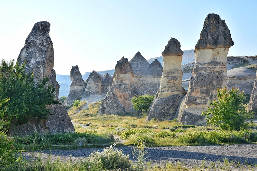
How to Plan a First Zemi Valley Hike
Choose the route direction before leaving the hotel. For a simple introduction, enter from Göreme, walk through the lower orchards and tunnels, then return along the same path.
For a one-way crossing, save the exact upper trailhead and show it to the driver. The words Zemi Valley are not precise enough because several dirt roads and panoramic pull-offs exist above the canyon.
Download an offline map and mark the intended exit. Mobile coverage can weaken inside enclosed sections, and an online map may place the trail on the wrong side of a drainage channel.
Carry water, a small light and shoes with reliable grip. Do not depend on finding a café, toilet, water tap or open church inside the valley.
Start early enough to allow for wrong turns, mud and closed passages. Zemi is not a sunset route, and the enclosed canyon loses useful light before the surrounding plateau.
What Makes Zemi Valley Different?
Zemi feels more enclosed than Love Valley, Rose Valley or the exposed ridges around Göreme. Parts of the route pass beneath trees and between close volcanic walls, with only short views of the open sky.
The valley is also less predictable. A path that is dry in summer may become a muddy water channel in spring. Agricultural work, erosion and fallen branches can alter small sections between visits.
Zemi is best suited to travelers who enjoy finding their way through a natural landscape rather than following a perfectly marked tourist circuit.
The valley combines natural drainage, agriculture and rock-cut heritage in one narrow corridor. Its orchards and storage spaces show that this was a working landscape rather than an empty wilderness.
That mixture also creates uncertainty. A path may divide around a field, enter a short tunnel or follow a seasonal channel before becoming clear again.
Visitors seeking a wide panorama and simple road access may prefer Love Valley or an upper sunset viewpoint. Zemi is stronger for close landscape detail, shade, tunnels and a quieter walking experience.
Where Is Zemi Valley?
Zemi lies south and southwest of central Göreme, close to the wider landscape around Göreme Open-Air Museum and the roads leading toward Ürgüp and Ortahisar.
It is not one straight path between two clearly marked gates. Zemi connects with Görkündere, agricultural tracks, church paths and several upper-road entrances.
This is why two hikers can record very different distances while both believe they completed the Zemi Valley route.
Some maps combine Zemi with Görkündere, while others separate the branches. Treat route names as planning labels rather than fixed official boundaries.
The lower Göreme-side approaches can also be confused with paths toward El Nazar, Saklı Church or the open-air museum road. Confirm the intended branch before following a church marker.
Private orchards and agricultural tracks remain active around several entrances. Park only in recognized areas and do not block field gates or narrow access roads.
How Long Does the Zemi Hike Take?
- Short Göreme-side walk: Approximately 3 to 4 kilometers and 1.5 to 2.5 hours
- Standard one-way crossing: Approximately 4 to 6 kilometers and 2 to 3.5 hours
- Extended route with Görkündere or church detours: Approximately 6 to 8 kilometers and 3 to 5 hours
These are practical planning ranges rather than official measurements. Walking from a hotel in central Göreme, following side paths or missing an exit can add considerable distance.
Time changes more than distance when the ground is wet. Mud, low tunnels and route-finding can double the time needed for a short section.
Church detours should be counted separately. A marker may appear close on a map while the approach requires climbing, crossing agricultural land or returning to the main path.
Choose a turnaround time, not only a destination. This makes it easier to leave enough daylight for the return when the route becomes slower than expected.
Which Direction Should You Walk?
The direction changes the character of the hike more than many visitors expect.
| Starting Point | Difficulty | Time | Main Advantage and Risk |
|---|---|---|---|
| Upper Road to Göreme | Moderate | Approximately 2 to 3.5 hours | More downhill walking and an easier finish near Göreme. The correct upper entrance can be difficult to identify. |
| Göreme Out-and-Back | Easy to moderate | Approximately 1.5 to 2.5 hours | Easy to begin without transport. You can explore the lower tunnels and return before the harder central sections. |
| Göreme to Upper Road | Moderate | Approximately 2.5 to 4 hours | Simple access from town, but the route climbs more toward the end and requires transport from the upper exit. |
The table describes general route logic, not a guarantee that every connection is open. Erosion, seasonal water and land use can alter the practical route.
Walking downhill from the upper road can reduce climbing, but descent on loose or muddy ground may be harder for people with knee or balance concerns.
Upper Road to Göreme
Starting from the upper side normally creates more descent and allows the walk to finish closer to Göreme's hotels, restaurants and taxi points.
The difficulty is finding the correct trailhead. Several dirt tracks and panoramic stops exist along the upper roads. Show the exact map point to the driver rather than asking only for Zemi Valley.
Wait until the driver confirms the path before leaving the vehicle. A nearby dirt road may lead to a farm, viewpoint or different valley branch.
Save the vehicle plate, driver number and drop-off pin. These details are useful if the entrance is unclear or the route must be abandoned.
Do not begin from an upper point late in the afternoon. A wrong entrance can use the remaining daylight before the main canyon is reached.
Göreme Out-and-Back
This is the safest choice for visitors who want to see the orchards, lower canyon and rock tunnels without committing to the entire crossing.
Choose a turnaround time before entering. Do not continue simply because the trail still looks easy. The return distance is easy to underestimate inside the enclosed valley.
The out-and-back option also avoids the transport problem at the upper road. It is the better choice when weather is uncertain or the group includes less-experienced hikers.
Turn around before the first difficult connector if the aim is a relaxed walk. The lower orchards and tunnel sections already provide a clear introduction to Zemi.
Where Does the Trail Finish in Göreme?
The lower branches eventually lead toward the wider road and church landscape near Göreme Open-Air Museum.
Related Tours
Popular experiences for this destination
 Adventure
Trekking Tours Cappadocia
Hike Cappadocia’s spectacular valleys, fairy chimneys, and cave dwelli…
Vip Mix Tour Cappadocia
Experience the ultimate Cappadocia highlights in comfort-historic vall…
 Adventure
ATV Tour Cappadocia
Ride powerful ATVs through Cappadocia’s unique valleys, fairy chimneys…
 Red Tour
Red Tour Cappadocia
Discover Göreme Open-Air Museum, Avanos pottery workshops, and breatht…
 Adventure
Horseback Riding Tour Cappadocia
Experience Cappadocia on horseback, riding through valleys, hidden tra…
Professional Photo Shoot Cappadocia
Capture your Cappadocia moments with a guided professional photo shoot…

Classic Car Tour Cappadocia
Step into nostalgia with a vintage classic car ride through Cappadocia…
 Blue Tour
Blue Tour Cappadocia
Explore hidden valleys, ancient churches, and cultural gems on Cappado…

Cappadocia Rent A Car
Explore Cappadocia freely at your own pace with flexible car rental op…

Nostalgic Electric Car Tour Cappadocia
Ride eco-friendly nostalgic electric cars through Cappadocia’s valleys…
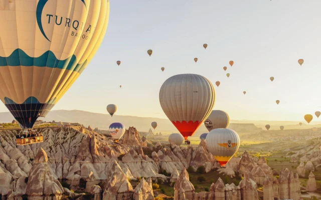 Balloon
Cappadocia Hot Air Balloon Tour
See Cappadocia from the air at sunrise on a professionally operated ho…
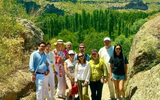 Green Tour
Green Tour Cappadocia
Explore Derinkuyu underground city, the beautiful Ihlara Valley, and S…
The final section can be confusing because agricultural paths, Görkündere connections and routes toward El Nazar separate near the edge of town.
When returning to Göreme, keep the Open-Air Museum road and the town skyline as general orientation points, but continue following the recognized path rather than cutting across orchards.
Download the route before entering. Mobile data can become weak inside narrow sections, and an online map may place the apparent trail on the wrong side of a drainage channel.
Near the lower exit, follow the established path even when the town appears close. Cutting across orchards can lead to fences, irrigation channels and private land.
Save a second map pin for the expected Göreme exit. This makes it easier to identify a wrong branch before walking far toward Görkündere or another church route.
Zemi's Low Rock Tunnels
The short rock tunnels are among Zemi's most memorable features. Some developed as natural water channels, while others may have been widened to support movement, farming or water management.
They are not long underground-city tunnels. Most return to daylight quickly, but the interiors can be darker, lower and wetter than photographs suggest.
Expect to bend beneath low ceilings and watch the top of your backpack. After rain, the floor may contain mud, shallow water and loose stones.
A phone light may be enough for a short passage, but a small flashlight makes it easier to see the ground while keeping the phone secure.
Do not enter a tunnel when water is flowing strongly through it or when the exit cannot be seen safely.
These passages should not be described as ancient underground-city tunnels without evidence. Some are natural erosion channels, while others may have been adapted for movement or water control.
Remove sunglasses before entering and allow your eyes to adjust. Keep both hands free where the floor is wet or uneven.
Large backpacks can catch on low ceilings. Move slowly and let one person complete a narrow passage before the next person enters.
Visitors uncomfortable in dark or low spaces can turn back rather than forcing the complete crossing. The lower valley remains worthwhile without entering every tunnel.
Steep Drops and Rope-Assisted Sections
Some route variations and older hiking reports describe steep rock drops where a rope has been left to assist hikers.
The exact location, height and condition of these sections can change. A rope attached by an unknown person is not maintained safety equipment and should never be trusted automatically.
If the route requires lowering your full body weight on an old rope, climbing a polished wall or passing a drop that feels unsafe, turn back and look for the recognized bypass.
These sections are especially difficult for visitors with knee problems, heavy camera equipment, large backpacks or dogs.
A normal public hiking route should not require technical climbing. Finding a dangerous obstacle usually means that you have entered a harder trail variation or an eroded section.
Do not assume that a rope proves the route is official. Ropes may be old, privately installed or damaged by weather, and their anchor points cannot be judged safely from below.
Look for a bypass or return to the previous junction. A longer recognized path is preferable to committing body weight to unmaintained equipment.
Groups should not pressure every member to continue. A section manageable for one person may be unsafe for another because of height, footwear, balance or pack weight.
Seasonal Water and Mud
Zemi follows a natural drainage system rather than a permanent riverside path.
Depending on the season, the same section may be completely dry, covered with soft mud or carrying shallow water beneath vegetation.
After heavy rain, water can collect quickly between the close canyon walls. Do not enter during a storm or immediately after severe rainfall without checking local conditions.
Spring is visually beautiful because the orchards and valley floor turn green, but it is also the season when mud can make the route unexpectedly slow.
Clay-rich mud can cling to shoes and reduce grip. Walk around deep sections only when a clear public path remains, not by entering cultivated ground.
Thunderstorms are a serious concern because Zemi functions as a drainage corridor. Leave the valley when heavy rain begins and do not shelter beneath fractured overhangs.
Winter ice may remain inside shaded tunnels after roads and open viewpoints have thawed. Test the surface before committing to a descent.
Orchards and the Human Landscape
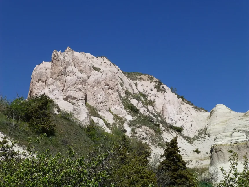
Zemi is greener partly because generations of local families cultivated its protected floor.
Apricot, almond, apple and other fruit trees grow beside vineyards, poplars and seasonal water channels. This is not untouched wilderness. Parts of the valley remain connected with active or recently used agricultural land.
Stay on the visible route and do not collect fruit without permission. A quiet orchard beside the trail may still belong to a local family.
Agricultural work can temporarily redirect the obvious path. Give tractors, workers and livestock enough space and follow any local instruction.
Do not climb terraces, damage irrigation channels or move field barriers to create a shortcut.
Livestock guardian dogs may be present near fields or grazing animals. Do not run, shout, feed them or approach livestock. Keep calm, remain with the group and move away slowly.
Rock-Cut Rooms and Pigeon Houses
The cliffs contain storage rooms, animal shelters, pigeon houses, burial spaces and religious structures.
Not every dark opening was a home or church. The valley supported agriculture as much as settlement.
Pigeon houses were used to collect manure for vineyards and fields. Other rooms stored fruit, grain, tools or agricultural products in the relatively stable temperature of the rock.
Many openings have weakened through erosion. Do not enter an unmarked cavity simply because it appears shallow from outside.
High openings may once have been reached by wooden ladders, balconies or sections of rock that no longer survive. Their current inaccessibility is part of the site's erosion history.
Pigeon-house facades are best viewed with a camera zoom. Climbing toward them damages the slope and exposes visitors to loose rock.
Storage rooms and shelters can be difficult to identify from one feature. Avoid labeling every carved chamber as a church, home or monastery cell.
Churches Around Zemi Valley
Sarnıç and Karabulut churches are closely associated with the Zemi and Görkündere landscape.
Saklı Church and El Nazar Church are nearby Göreme monuments, but they are not automatic stops on every Zemi route.
The churches around Zemi belong to different routes and access arrangements. Their names appearing together on a map does not mean they can be visited in one continuous, maintained circuit.
Church access can change because of conservation, locked entrances, private land or unstable approaches. Plan the hike around the valley itself and treat an open church as an additional opportunity.
Do not use flash when prohibited, touch painted surfaces or enter beyond barriers. Moisture and human contact continue to damage surviving frescoes.
Sarnıç Church
Sarnıç Kilise means Cistern Church. The name reflects a later use or condition of the carved space rather than its original religious purpose.
The church contains painted saints and New Testament subjects. Moisture, reuse and changing environmental conditions have affected the interior.
The approach may not be clearly maintained. Do not cross farmland or descend through an unstable opening only because a map marker appears nearby.
The later use implied by the Turkish name should be separated from the church's original function. Rock-cut spaces in Cappadocia were often adapted long after their religious use changed.
Check the route from a recognized path rather than following the map marker in a straight line. Elevation and private land can make a nearby point difficult to reach safely.
Karabulut Church
Karabulut Church belongs to the wider Görkündere and Zemi church landscape.
Its Turkish name means Black Cloud. It should not be confused with Dark Church inside Göreme Open-Air Museum.
The approach may involve steep or unofficial-looking paths. Confirm current access rather than following an old route description blindly.
The name Black Cloud is a modern Turkish label and should not be used to invent a historical story about the church. Its architecture and surviving decoration provide more reliable evidence.
When the approach looks eroded or unsupported, view the surrounding landscape from the main route and continue without entering.
Saklı Church
Saklı Church, meaning Hidden Church, was revealed after a rockfall exposed its entrance during the 20th century.
The church is often protected by a locked entrance, and access arrangements can change. Do not expect to arrive independently and find the door open.
Ask official museum or site staff about the current visiting procedure before beginning the hike. Do not attempt to locate a private key holder or force an entrance.
Saklı Church is generally dated to the post-Iconoclastic Byzantine period and is known for painted decoration, but current access matters more than an expected interior visit.
A locked door protects both the monument and visitors. Do not climb around the entrance or search for another opening.
El Nazar Church
El Nazar Church is carved into an isolated rock formation near Göreme and contains scenes from the life, miracles and Passion of Christ.
It can be added to the same day, but it requires separate route and access planning. It should not be described as a guaranteed stop directly on the main Zemi trail.
El Nazar is commonly associated with 10th-century Byzantine painting. The monument stands in a separate rock formation, so its access should be checked independently from the Zemi hike.
Schedule it before the valley or after a short route. Adding it after a full crossing can create a late finish and rushed church visit.
Zemi Valley Reality: No Shops and No Guaranteed Open Churches
Do not enter Zemi expecting cafés, toilets, water points or permanently open churches.
Facilities inside the valley are extremely limited. Use the restroom and obtain water in Göreme before starting.
Church doors may be locked because of conservation, rockfall risk, private land, seasonal trail damage or the absence of staff.
An online map marker proves only that a place has been recorded. It does not prove that the building is open, safe or reachable from the current public path.
Carry more water than a normal town walk requires, especially in summer. Shade is uneven and the upper sections can be hot even when the lower canyon feels cool.
Use toilets in Göreme before starting. Do not leave tissue, bottles or food packaging near tunnels, orchards or church approaches.
Keep some battery in reserve for navigation and transport. Continuous filming can leave the phone unusable when the route becomes unclear.
How Difficult Is Zemi Valley?
Under dry conditions, the lower sections are manageable for regular walkers. The complete crossing becomes more demanding because of mud, low tunnels, loose soil, unclear junctions and occasional steep connectors.
Difficulty depends on conditions and direction rather than distance alone. A short muddy descent can be harder than a longer dry path.
People with knee concerns may prefer a lower out-and-back walk because downhill travel from the upper road can place more strain on joints.
Possible difficulties include:
- Low rock tunnels
- Seasonal water channels
- Slippery mud and wet leaves
- Short steep slopes
- Old or unofficial rope-assisted sections
- Unmarked agricultural paths
- Fallen branches and eroded ground
- Limited phone reception
The route is unsuitable for wheelchairs and pushchairs. Older active children may enjoy a shorter Göreme-side walk, but they must remain close to an adult around tunnels, drops and muddy water channels.
A child carrier may be more practical than a stroller, but low tunnels, slippery ground and narrow branches still require careful judgment.
Related Tours
Popular experiences for this destination
AdventureTrekking Tours Cappadocia
Hike Cappadocia’s spectacular valleys, fairy chimneys, and cave dwelli…
Vip Mix Tour Cappadocia
Experience the ultimate Cappadocia highlights in comfort-historic vall…
AdventureATV Tour Cappadocia
Ride powerful ATVs through Cappadocia’s unique valleys, fairy chimneys…
Red TourRed Tour Cappadocia
Discover Göreme Open-Air Museum, Avanos pottery workshops, and breatht…
AdventureHorseback Riding Tour Cappadocia
Experience Cappadocia on horseback, riding through valleys, hidden tra…
Professional Photo Shoot Cappadocia
Capture your Cappadocia moments with a guided professional photo shoot…
Classic Car Tour Cappadocia
Step into nostalgia with a vintage classic car ride through Cappadocia…
Blue TourBlue Tour Cappadocia
Explore hidden valleys, ancient churches, and cultural gems on Cappado…
Cappadocia Rent A Car
Explore Cappadocia freely at your own pace with flexible car rental op…
Nostalgic Electric Car Tour Cappadocia
Ride eco-friendly nostalgic electric cars through Cappadocia’s valleys…
BalloonCappadocia Hot Air Balloon Tour
See Cappadocia from the air at sunrise on a professionally operated ho…
Green TourGreen Tour Cappadocia
Explore Derinkuyu underground city, the beautiful Ihlara Valley, and S…
Dogs may struggle with ladders, steep connectors and livestock encounters. Do not attempt a full crossing with a dog unless the route and bypasses are already understood.
Best Time to Walk Zemi
Spring
Fruit blossoms and fresh vegetation make spring especially attractive. Rain may create deep mud and fast runoff in narrow sections.
Summer
The enclosed valley provides more shade than open ridges, but upper sections can still become hot. Begin early and do not rely on finding water inside.
Autumn
Autumn offers cooler temperatures and changing colors among the fruit trees. Dry conditions often make the route easier.
Winter
Snow can make the valley beautiful but difficult to assess. Ice may remain inside shaded tunnels and on steep slopes after open roads have cleared.
Winter route markings can disappear beneath snow. Choose a short familiar section or a guided walk rather than relying on an old GPS track.
Time of Day
Morning is the most reliable time for a complete crossing because it leaves room for route mistakes and unexpected closures.
Zemi is not a sunset viewpoint. Its enclosed floor loses direct light earlier than the surrounding plateau. Finish the trail before sunset and continue to a road-accessible viewpoint for the final light.
Late-afternoon shadows also make drainage channels and junctions harder to distinguish. Leave a daylight margin rather than planning to reach Göreme exactly at sunset.
Can You See Balloons From Zemi?
Balloons may appear from upper sections when the wind brings flights toward the area, but the valley floor is not a reliable sunrise viewpoint.
Cliffs and trees block much of the sky. Travelers whose priority is balloon photography should choose a recognized open viewpoint instead.
Use the Cappadocia hot-air balloon guide when selecting a sunrise location.
Entering Zemi before dawn adds navigation and footing risks without guaranteeing balloons. Use an open, road-accessible viewpoint when sunrise photography is the priority.
Guided or Independent?
Independent Walk
A short out-and-back route from Göreme is suitable for visitors with offline navigation, suitable footwear and enough daylight.
Choose the turnaround point before entering and do not depend only on mobile data.
Independent hikers should be willing to turn back when mud, water or a steep connector makes the planned route unsafe. Completing the full crossing is not necessary for a successful visit.
Guided Crossing
A guided Cappadocia trekking tour is more useful for a complete one-way crossing, church identification and transport from the upper entrance.
A local guide can also distinguish the main Zemi path from Görkündere branches and agricultural tracks that look convincing but lead away from the intended exit.
Ask whether upper-road transport, church access and route adjustments are included. A fixed trail plan should be changed when weather or erosion affects the normal path.
Can ATVs or Horses Enter Zemi?
Zemi's narrow tunnels, orchards, church paths and drainage channels make the main hiking route unsuitable for ordinary ATV traffic.
Motorized vehicles should remain on routes where they are specifically authorised. Protected walking paths and fragile agricultural areas should not be entered.
Visitors joining a Cappadocia ATV tour should confirm that the operator follows current route restrictions.
Motorized traffic accelerates erosion and can damage agricultural ground when it leaves authorized tracks. Hikers should not assume that tire marks identify the correct walking route.
Horse routes may use wider agricultural tracks around the valley, but narrow tunnels and steep connectors are not suitable for every riding group. Follow the operator's current route rather than expecting a complete Zemi crossing.
How to Reach Zemi Valley
From Central Göreme
The lower valley can be approached on foot from Göreme, although walking from the hotel adds distance before the natural trail begins.
Ask for the current entrance. Not every unpaved road on the southern edge of Göreme leads into the correct branch.
Hotel staff or a guide can help identify the current lower trailhead, but save the map point before leaving town. Construction and agricultural access can alter the most obvious approach.
From the Upper Road
A taxi or private transfer can leave hikers near an upper entrance.
Show the driver the exact saved point. Several dirt roads, farms and panoramic pull-offs exist in the area.
Confirm that the driver will wait until the entrance is identified. Being dropped at the nearest panorama can leave hikers on the wrong side of the drainage network.
By Rental Car
A rental car is inconvenient for a one-way crossing because the vehicle remains at the starting point.
Choose an out-and-back route or arrange a second transfer.
Do not leave valuables visible in the parked vehicle. Confirm that the parking position does not block agricultural access and remains usable when the hike ends.
Review the guide to getting to and around Cappadocia before planning independent transport.
Suggested Short Zemi Walk
- Start: Enter from the confirmed Göreme-side trailhead.
- Lower valley: Follow the orchards and seasonal drainage channel.
- Tunnel section: Continue through the accessible short rock passages.
- Turnaround: Return before the central route becomes steep or unclear.
- Finish: Walk back into Göreme for lunch or continue to a nearby church when current access is confirmed.
Suggested One-Way Crossing
This route should remain flexible. Turn around earlier when water enters the tunnels, mud becomes deep or the path divides into unclear agricultural tracks.
A short Zemi walk can be combined with lunch in Göreme or a separately confirmed church visit without creating a rushed day.
Suggested One-Way Crossing
- Transport: Arrange a taxi to the exact upper entrance.
- Start: Confirm that the route is open and descending toward Göreme.
- Middle section: Follow the principal canyon path and avoid unnecessary side branches.
- Tunnels: Check for water and mud before entering.
- Lower exit: Follow recognized paths toward the Göreme Open-Air Museum road.
- Finish: Return to central Göreme before darkness.
Combine Zemi With Göreme Open-Air Museum
Send the upper entrance and expected lower exit to someone outside the group before starting. This provides a reference if the route changes.
Do not add every church detour during a first crossing. Complete the main route with enough daylight, then plan access-sensitive churches separately.
Combine Zemi With Göreme Open-Air Museum
Zemi can be combined with the Göreme Open-Air Museum, but the day should not be overloaded.
- Visit the museum early in the morning.
- Return to Göreme for lunch.
- Complete a short or standard Zemi route during the afternoon.
- Visit El Nazar only when access and remaining daylight allow.
- Finish at a road-accessible viewpoint rather than staying inside the valley for sunset.
Places to Visit Near Zemi
The museum can require several hours, especially when Tokalı Church and paid interior sections are included. Choose a short Zemi route afterward rather than assuming enough time remains for a complete crossing.
In summer, the valley may be more comfortable after lunch than exposed viewpoints, but late entry still requires a daylight margin.
Places to Visit Near Zemi
Göreme Open-Air Museum
The Göreme Open-Air Museum contains major Byzantine churches, monastic rooms and important fresco programs.
Saklı Church
Saklı Church is an important but access-sensitive monument within the wider Göreme church landscape.
El Nazar Church
El Nazar Church preserves painted scenes inside an isolated rock formation close to Göreme.
Love Valley
Love Valley offers tall pillar-shaped formations and a much more open landscape.
Rose and Red Valleys
The Rose and Red Valleys provide longer route combinations, churches and the Kızılçukur sunset viewpoint.
Göreme Sunset Point
Göreme Sunset Point is a practical panoramic stop after completing the enclosed valley route.
Nearby attractions should be selected according to energy and daylight. Göreme Open-Air Museum, El Nazar and the upper parts of Çavuşin each involve additional walking.
For a first visit, combine Zemi with one major nearby site rather than turning the day into a sequence of rushed trailheads.
Explore Zemi With a Local Hiking Guide
Zemi's difficulty is not its total distance. The real challenge is identifying the correct entrance, choosing the right branch and knowing when a steep connector is no longer worth following.
A private Cappadocia hiking tour can combine the valley with selected churches and handle transport for a one-way route.
This is the strongest option for travelers who want to see the tunnels and rock-cut heritage without spending the walk checking every junction on a phone.
A guide is also useful after heavy seasonal change, when normal connectors may be muddy, eroded or less visible.
Responsible Hiking
Common Zemi Valley Planning Mistakes
- Searching only for Zemi Valley: Upper and lower trailheads can be far apart by road.
- Beginning without a turnaround time: Enclosed terrain makes the return distance easy to underestimate.
- Trusting an old rope: Unmaintained equipment is not proof of a safe public route.
- Following tire tracks: Agricultural or motorized routes may leave the hiking corridor.
- Entering after heavy rain: The valley functions as a drainage channel and can become muddy or unsafe.
- Expecting open churches: Locked doors, unstable approaches and conservation work can change access.
- Using sunset as the finish time: The canyon loses light before the plateau.
- Walking through orchards as a shortcut: Private agricultural land remains active.
- Relying on mobile data: Offline navigation and saved exit points are essential.
Responsible Hiking
- Download an offline route before entering.
- Do not hike during heavy rain or thunderstorms.
- Stay on recognized paths.
- Do not trust old ropes as maintained safety equipment.
- Do not enter locked or unstable caves.
- Do not touch frescoes or carved decoration.
- Do not pick fruit without permission.
- Do not drive motor vehicles onto narrow hiking paths.
- Carry all trash back to Göreme.
- Complete the route before darkness.
- Review the Cappadocia safety and essentials guide before hiking independently.
Questions Travelers Ask About Zemi Valley
Is Zemi Valley worth hiking?
Yes. Zemi provides a quieter, greener and more enclosed hiking experience than Cappadocia's open panoramic valleys.
How long is the Zemi hike?
Most routes cover approximately 4 to 7 kilometers. Distance changes according to the entrance, exit and church detours.
Which direction is easier?
Beginning from the upper road and finishing in Göreme usually involves more descent. The main challenge is locating the correct upper entrance.
Can you walk only part of the valley?
Yes. An out-and-back walk from the Göreme side allows visitors to see orchards and tunnels without completing the full crossing.
Are there dangerous rope sections?
Some route variations may contain old rope-assisted drops. Their condition is not guaranteed. Turn back when a section requires unsafe climbing or trusting an unmaintained rope.
Are the tunnels wet?
They may be dry, muddy or covered by shallow seasonal water depending on recent rainfall.
Are the churches open?
Not always. Entrances may be locked or inaccessible because of conservation, rockfall risk, private land and trail damage.
Can you enter Saklı Church during the hike?
Saklı Church requires separate access confirmation and should not be assumed to be open during a standard Zemi walk.
Do you need a guide?
A guide is not necessary for a short lower-valley walk. It is useful for a complete crossing, church interpretation and transport planning.
Can children hike Zemi?
Older active children may enjoy shorter sections under close supervision. Mud, tunnels, drops and limited facilities make the full route unsuitable for very young children.
Is Zemi Valley clearly marked?
Not consistently. Signs and visible tracks can vary, especially near orchards, Görkündere branches and upper-road entrances. Use offline navigation and a confirmed trailhead.
Can you hike Zemi after rain?
A short section may remain possible, but mud, runoff and water inside tunnels can make the route slow or unsafe. Avoid the valley during storms and check local conditions after heavy rainfall.
Are there toilets or cafés inside Zemi?
No reliable facilities should be expected. Use toilets and buy water in Göreme before starting.
Is the upper-road route suitable for beginners?
It can be manageable in dry conditions, but locating the entrance and handling steep or muddy descents require preparation. Beginners may prefer the lower out-and-back route.
Can you combine Zemi with El Nazar Church?
Yes, when access is confirmed and enough daylight remains. El Nazar is a separate monument and should not be assumed to lie directly on the main Zemi path.
How Zemi Valley Fits Into a Cappadocia Itinerary
Zemi is not memorable because of one famous viewpoint. Its character comes from the gradual change between orchards, water channels, tunnels, pigeon houses and enclosed volcanic walls.
The valley also shows how close everyday agricultural life once existed to Göreme's major churches and settlements.
It rewards visitors who accept that the route may be muddy, imperfectly marked and different from the map.
Zemi works best as a half-day nature and heritage route rather than a quick viewpoint stop. The value comes from moving gradually between cultivated land, tunnels, carved rooms and enclosed rock walls.
A careful visit separates recognized hiking paths from agricultural tracks, treats church access as variable and turns back before an unsafe rope or eroded connector.
For most first-time visitors, a shorter Göreme-side walk provides a better introduction than attempting a complete crossing without clear transport or navigation.
Include Zemi in a 3-day Cappadocia itinerary or use the Cappadocia trip planning guide to combine it with Göreme Open-Air Museum and nearby churches.